Start your trail of Manor Farm Park at the Farm buildings.
Farm buildings
These agricultural buildings – known as Manor Farm - were constructed in 1895 by the Cadburys. At present they are used by the City Council’s parks team as a maintenance depot.
%20(1).JPG) Farm buildings at Manor Farm Park (June 2010). Photography by Elliott Brown
Farm buildings at Manor Farm Park (June 2010). Photography by Elliott Brown
Site of the Cadbury Barn
In 1895 George and Elizabeth Cadbury had a rustic wooden ‘barn’ constructed to provide a venue for summer entertainments for their workers and their families. The building, which could seat up to 700 people, also hosted numerous parties for children from the poorer parts of Birmingham, enabling them to enjoy a day out in the countryside. Sadly this building was destroyed by fire in 2017.
%20(3).JPG) Cadbury Barn at Manor Farm Park (June 2010). Photography by Elliott Brown
Cadbury Barn at Manor Farm Park (June 2010). Photography by Elliott Brown
Ridge and furrow
Faint traces of medieval ridge and furrow ploughing can be seen in parts of the park, a reminder of the landscape’s distant agricultural history.
Bath and Paddling Beach
The Cadburys diverted the course of Griffin’s Book and created a Paddling Beach and Bath for their children’s summer parties. Although traces of these last two features survive, neither are clearly visible today.
Lake
The Lake (also known as the Fish Pond) was created during the 19th century by damming Griffin’s Brook. It originally featured a Boat House which is marked on the 1884 First Edition and later OS maps.
%20(7).JPG) Lake at Manor Farm Park (June 2010). Photography by Elliott Brown
Lake at Manor Farm Park (June 2010). Photography by Elliott Brown
Manor House
Northfield Manor was originally a farmhouse called New House Farm. In 1835 the farm was purchased by Joseph Frederick Ledsam, a local manufacturer and landowner. He altered and extended the building, and in his will of 1861 it was referred to as Northfield Manor House. In 1894 the house was acquired by George and Elizabeth Cadbury who turned it into a comfortable suburban mansion. Unfortunately the manor was destroyed by fire in 2014, although a reconstruction has been built as part of the adjacent residential development.
.jpg) Northfield Manor House (April 2022). Photography by Elliott Brown
Northfield Manor House (April 2022). Photography by Elliott Brown
Ancient Hedgerow
Parts of an ancient hedgerow dating from the 16th century survive on the western side of the Great Meadow, another reminder of the park’s rural origins.
.JPG) Ancient Hedgerow in Manor Farm Park (December 2019) Photography by Elliott Brown
Ancient Hedgerow in Manor Farm Park (December 2019) Photography by Elliott Brown
Old Park Farm
Grade II listed Old Park Farm dates from around 1800. Although no longer a working farm and now a private home, the house, which has had many changes over the years, is nonetheless a rare survival form the area’s agricultural past.
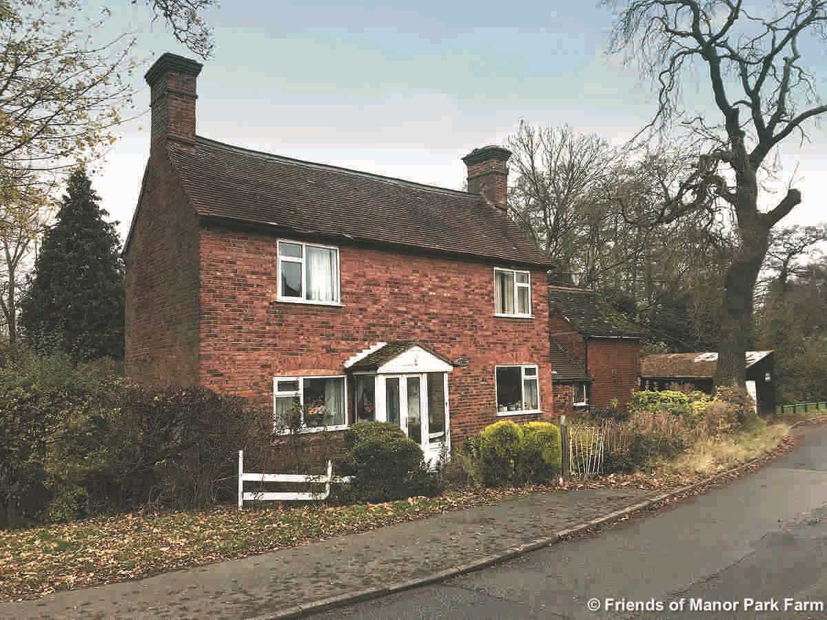 Old Park Farm courtesy The Friends of Manor Farm Park
Elan Aqueduct
A short section of the Elan Aqueduct runs under the southern corner of the park. The aqueduct was constructed between 1896 and 1906 to provide a proper drinking water supply for the city of Birmingham. Constructed mainly underground, the aqueduct runs 73 miles from the Elan Valley in Mid-Wales to Frankley Reservoir.
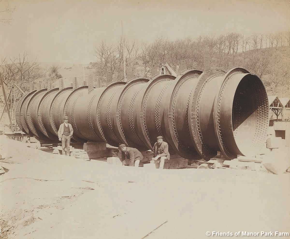 Elan Aqueduct courtesy The Friends of Manor Farm Park
Northfield Manor Gate Lodge
Although Northfield Manor House has now been lost, its attractive gate lodge and stone gate piers c1895 survive at the entrance into New House Farm Drive 100 metres up the Bristol Road from the Park.
.JPG) Northfield Manor Gate Lodge at New House Farm Drive (March 2012). Photography by Elliott Brown
Northfield Manor Gate Lodge at New House Farm Drive (March 2012). Photography by Elliott Brown
You have completed your tour of Manor Farm Park.
We hope you enjoyed the trail.
Special thanks to Chris Rice for words.