The River Cole flows for 25 miles through Birmingham via the Kingfisher Country Park and the Shire Country Park.
.jpg)
River Cole from Robin Hood Lane near the John Morris Jones Walkway (January 2021). Photography by Elliott Brown
Route of the River Cole in Birmingham
From the south it heads north via Mill Lodge Park in Solihull (near Shirley). It then enters the Shire Country Park at the Scribers Lane SINC, passing the fords at Slade Lane and Scribers Lane. It is now in Yardley Wood. The River Cole next passes the Trittiford Mill Pool, The Dingles and the John Morris Jones Walkway. After that it flows past Sarehole Mill towards the ford at Green Road in Hall Green (which can be driven into). It continues via the Greet Mill Meadow (which has stepping stones to cross if you want to). Passing the Stratford Road via the Blackberry Way and Burbury Brickworks Nature Reserve in Sparkhill. Before passing the Warwick Road and The Ackers. It later heads into the Kingfisher Country Park near Stechford, and then onto Shard End. Eventually crossing back into Solihull in Chelmsley Wood.
The River Cole at Mill Lodge Park
The River Cole heads north through Solihull. Enters the park at Aqueduct Road and Green Lane. It goes under Colebrook Road beyond Mill Lodge Park, and continues past Nethercote Gardens before it crosses the Solihull / Birmingham border, entering the Scribers Lane SINC in Yardley Wood.
 (5).JPG)
River Cole at Mill Lodge Park (May 2020). Photography by Elliott Brown
The River Cole in the Shire Country Park
The River Cole at the Scribers Lane SINC
Entering Yardley Wood, the River Cole flows north through the Scribers Lane Site of Importance to Nature Conservation. There is two fords here, one at Slade Lane, the other at Scribers Lane. Neither of which can be driven through, as there is bollards. But they both have footbridge for pedestrians and cyclists to cross over. It next passes the Trittiford Mill Pool.
 (1).jpg)
River Cole at the Scribers Lane ford (May 2020). Photography by Elliott Brown
The River Cole at the Trittiford Mill Pool
The River Cole heads in a north western direction past the Trittiford Mill Pool. With the Shakespeare Line to the right of it. Sometimes the river is hard to see from the path, except when they cut down all the shrubbery. It leaves the mill pool at Highfield Road before next flowing north through The Dingles towards Hall Green. Closest railway station is Yardley Wood Station on Highfield Road.
 (1).JPG)
River Cole at the Trittiford Mill Pool near Highfield Road (January 2021). Photography by Elliott Brown
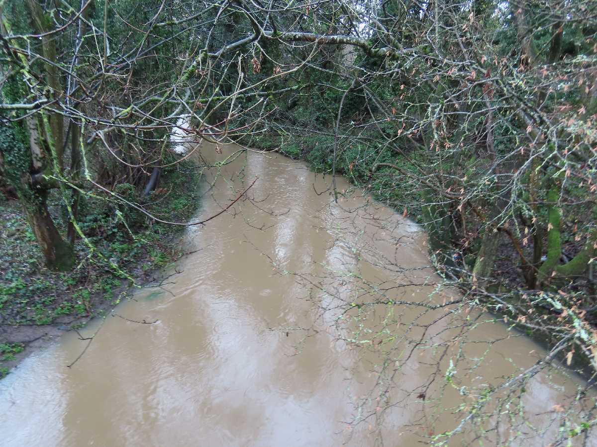
The River Cole in The Dingles
From Highfield Road in Yardley Wood, the River Cole heads north through The Dingles, where the Chinn Brook joins it halfway up. It continues until it crosses into Hall Green at the Robin Hood Lane, before going past the John Morris Jones Walkway.
 (7).jpg)
River Cole in The Dingles (March 2020). Photography by Elliott Brown
The River Cole through the John Morris Jones Walkway
Into Hall Green via the John Morris Jones Walkway. From Robin Hood Lane to Cole Bank Road. The River Cole heads north towards Sarehole Mill. There is a field to the west that is sometimes used for Tolkien related events. Named after John Morris Jones who was Headmaster at George Dixon Junior School from 1960 to 1980. He wrote about the Sarehole, Hall Green and Yardley Wood areas.
 (9).jpg)
River Cole at the John Morris Jones Walkway (March 2020). Photography by Elliott Brown
River Cole from the Cole Bank Road bridge
After the John Morris Jones Walkway, the River Cole goes under the Cole Bank Road bridge, close to Sarehole Mill. There is a bus stop on this bridge for the 5 (towards Solihull) and 11A (towards Acocks Green).
 River Cole from Cole Bank Road (December 2023). Photography by Elliott Brown
River Cole at the Sarehole Mill Recreation Ground
Passing Sarehole Mill at the Hall Green / Moseley border at Cole Bank Road. The river flows north towards Green Road. There is also a mill stream that connects the river to the Mill Pond at Sarehole Mill. To the west of the river is the Recreation Ground north of Sarehole Mill.
 (2).jpg)
River Cole at the Sarehole Mill Recreation Ground (April 2020). Photography by Elliott Brown
River Cole at the Green Road ford
In Hall Green, the River Cole flows through Green Road. Where you can see cars driving throught the river. But when it rains, the river can flood here, and it is advisable to not drive through it. There is a footbridge for pedestrians and cyclists. People wearing wellies might walk through the river if they are brave! (as well as dogs). It is near the entrance to the Greet Mill Meadow.
 (3).jpg)
River Cole at the Green Road ford (April 2020). Photography by Elliott Brown
The River Cole at the Greet Mill Meadow
From Green Road, the River Cole flows through the Greet Mill Meadow towards the Stratford Road and the Hall Green / Sparkhill border. At certain points, there is stepping stones that you could cross. But if they are wet, it is best to stick to the main path on your walk (in case you fall into the river by mistake). But try to be careful if you cross over them. Near the Stratford Road is a Mughlai cuisine restaurant in a former church called Mughal-e-Azam (formerly the Sparkhill United Church, a Grade II listed building).
 (5).jpg)
Stepping stones on the River Cole at the Greet Mill Meadow (May 2020). Photography by Elliott Brown
River Cole at the Blackberry Way
From the Stratford Road in Sparkhill, the River Cole heads north towards Formans Road. It's a bit hard to see the river from the path here, but to the west is the Knowle Road Allotments. There is usually a litter problem around here, so rubbish might be in the river, or on or around the path.
 (3).jpg)
River Cole at the Blackberry Way (May 2020). Photography by Elliott Brown
The River Cole at the Burbury Brickworks Nature Reserve
Still in Sparkhill, the River Cole next goes north from Formans Road into the Burbury Brickworks Nature Reserve (formerly the site of a brickworks). It heads near the Cole Valley Business Park and the Warwick Road near Greet and Tyseley.
 (7).jpg)
River Cole from the Burbury Brickworks Nature Reserve (May 2020). Photography by Elliott Brown
The River Cole at the Greet Bridge
Next the River Cole passes under the Greet Bridge on the Warwick Road. The bridge was built in 1902 in the Coronation year of King Edward VII. After this, the river flows in a north eastern direction towards The Ackers. Where it connects to the Spark Brook, and flows under the Snow Hill lines (between Tyseley and Small Heath stations) and the Grand Union Canal.
 (5).jpg)
The River Cole at the Greet Bridge (April 2018). Photography by Elliott Brown
The River Cole at the Fordrough Bridge
The River Cole is now in Hay Mills, near Webster & Horsfall. The Fordrough Bridge was built in 1983. It is near the A45 Small Heath Bypass (aka the Small Heath Highway). The Heybarnes Retail Park is to the east and is near Heybarnes Circus and the Coventry Road. Beyond here is the start of the Kingfisher Country Park.
 (3).jpg)
River Cole at the Fordrough Bridge (October 2020). Photography by Elliott Brown
The River Cole in the Kingfisher Country Park
The River Cole at the Haymills Old Bridge
The Kingfisher Country Park starts from the Coventry Road at the Haymills Old Bridge, dated 1903. This is the entrance to the Hay Barn Recreation Ground. There is a footbridge halfway into the recreation ground that leads towards Dale Walk and Berkeley Road. Beyond here is Hob Moor Road. After which is the Newbridge Recreation Ground (former site of Newbridge Farm). There is a lot of litter in the river, the trees and along the path. Part of the Cole Valley Route.
 (1).jpg)
River Cole at the Haymills Old Bridge in Hay Mills (April 2021). Photography by Elliott Brown
The River Cole at the Yardley Green Road Bridge
Between the Newbridge Farm Recreation Ground and the Sycamores Recreation Ground, is Yardley Green Road in Bordesley Green. It is a double bridge, with one side for traffic, and the other side for pedestrians. The River Cole isn't really visible from the Cole Valley Route path in both recreation grounds.
.jpg)
Yardley Green Road Bridge in the Kingfisher Country Park (April 2021). Photography by Elliott Brown
The River Cole at the Bordesley Green East Bridge
In Bordesley Green on the Bordesley Green East Bridge, the River Cole flows north from the Sycamore Recreation Ground (which is split into a west and east section). Then into the Bordesley Green Recreation Ground (former site of Batchelors Farm). On the right of the river is the Morden Road Recreation Ground. Beyond here is the West Coast Mainline, and you would have to exit the recreation ground onto the main roads, if you want to continue your walk or cycle. After the railway is Cotterills Lane Recreation Ground, and you are also close to Stechford Station.
 (1).jpg)
River Cole at Bordesley Green East (April 2021). Photography by Elliott Brown
The River Cole at the Station Road Bridge
In the Kingfisher Country Park, the River Cole flows towards the Station Road Bridge in Stechford. Not far from here is Gumbleberrys Pond. Was also a Fairground Site to the north east. Nearby is the Cole Valley Cycle Route, which you can get onto from Stechford Lane. Beyond here the route of the river goes towards Hodge Hill near the Colebourne Meadow, Glebe Farm Recreation Ground and the Brook Meadow on the way to Shard End.
.jpg)
River Cole at the Station Road Bridge in Stechford (December 2018). Photography by Elliott Brown
The River Cole at Shard End
In Shard End, the River Cole enters this part of the Kingfisher Country Park at Packington Avenue near the Lea Ford Playing Fields. The Norman Chamberlain Playing Fields is on the other side of the river (this would be where you find Shard End Lake). It flows to the south, then to the north east to the Birmingham / Solihull border where it enters Kingshurst, near Babbs Mill Local Nature Reserve.
 (3).jpg)
The River Cole in Shard End at the Kingfisher Country Park (December 2020). Photography by Elliott Brown
The River Cole in Babbs Mill Jubilee Park
In Kingshurst, Solihull, the River Cole flows through what is now called Babbs Mill Jubilee Park. It runs to the south of Babbs Mill Lake through Babbs Mill Local Nature Reserve. It then flows to the south towards Cooks Lane. Beyond here, the river flows south towards Meriden Park and Cole Bank Park, before crossing under the M6 and M42 towards Coleshill.
 (4).jpg)
River Cole in Babbs Mill Jubilee Park (December 2020). Photography by Elliott Brown